Monitoring & Evidence
Our objectives can be achieved through various means such as but not...
View page
Discover the team our mandate and everything we stand for.
Monitoring & Evidence
Our objectives can be achieved through various means such as but not...
View pageOur Vision
The special qualities of the Cornwall AONB are conserved, enhanced and appreciated...
View pageThe Management Plan
The Management Plan is a shared strategy for those who live, work...
View pageThe Management Plan review
This is the first of two consultation and we invite you all...
View pageWhat is Natural Beauty?
Areas of Outstanding Natural Beauty are protected landscapes whose distinctive character and...
View pageThrough effective Partnership working the protected landscape plays a crucial role in nature recovery, resilience to climate change and conservation of the historic and natural environment, by consideration of four key priorities
Priority-Climate
The climate emergency is the defining challenge of our time. In January...
View pagePriority-Nature
Set against a backdrop of unprecedented concern for the future of the...
View pagePriority-People
Communities in the Cornwall AONB live entirely outside the main towns, within...
View pagePriority-Place
The Cornwall AONB is unique and special. The beauty and character of...
View pageThe hub for partners, stakeholders and strategic organisations engaged with Cornwall National Landscape.
Executive Board & Governance
The Cornwall AONB is governed by a partnership of 20 organisations
View pageFunders and Project Partners
The role of our funding partners.
View pagePartners & Organisations Directory
The organisations supporting Cornwall National Landscape.
View pageStakeholder Strategies
We work to influence the shape of forthcoming strategies.
View pageStrategy for Cornwall National Landscape
The Cornwall AONB Strategy in the context of international, national, regional and...
View pageOur role is to provide Planning, and related, consultations; Consultations on Local Plans and Neighbourhood Development Plans and Pre-application consultations made to Cornwall National Landscape.
Agriculture & Farming Transition
Supporting farmers to achieve a sustainable and profitable farm business and deliver...
View pageDevelopment Pressures
The statutory purpose of the designation is to conserve and enhance the...
View pageLandscape-led development
Development within and affecting the Cornwall AONB, should be ‘landscape-led’.
View pageNature Recovery & Environment Act
Local Nature Recovery Strategies (LNRS) are plans for supporting nature in local...
View pagePlanning Responses
The responses we gave to planning matters inside any of our the...
View pageThe Cornwall Local Plan
The Cornwall Local Plan contains policies both specific to the designated landscape...
View pageWe are committed to supporting farmers to achieve a sustainable and profitable farm business and deliver outcomes for people, place, nature and climate.
Welcome the Community Hub for Cornwall National Landscape.
Discover the team our mandate and everything we stand for.
Monitoring & Evidence
Our objectives can be achieved through various means such as but not limited to, projects, collaborative...
View pageOur Vision
The special qualities of the Cornwall AONB are conserved, enhanced and appreciated by all who live,...
View pageThe Management Plan
The Management Plan is a shared strategy for those who live, work and visit the Cornwall...
View pageThe Management Plan review
This is the first of two consultation and we invite you all to complete the one...
View pageWhat is Natural Beauty?
Areas of Outstanding Natural Beauty are protected landscapes whose distinctive character and natural beauty are so...
View pageThrough effective Partnership working the protected landscape plays a crucial role in nature recovery, resilience to climate change and conservation of the historic and natural environment, by consideration of four key priorities
Priority-Climate
The climate emergency is the defining challenge of our time. In January 2019, Cornwall Council declared...
View pagePriority-Nature
Set against a backdrop of unprecedented concern for the future of the natural world and ecological...
View pagePriority-People
Communities in the Cornwall AONB live entirely outside the main towns, within villages, hamlets and scattered...
View pagePriority-Place
The Cornwall AONB is unique and special. The beauty and character of the AONB is primarily...
View pageThe hub for partners, stakeholders and strategic organisations engaged with Cornwall National Landscape.
Executive Board & Governance
The Cornwall AONB is governed by a partnership of 20 organisations
View pageFunders and Project Partners
The role of our funding partners.
View pagePartners & Organisations Directory
The organisations supporting Cornwall National Landscape.
View pageStakeholder Strategies
We work to influence the shape of forthcoming strategies.
View pageStrategy for Cornwall National Landscape
The Cornwall AONB Strategy in the context of international, national, regional and local priorities and goals.
View pageOur role is to provide Planning, and related, consultations; Consultations on Local Plans and Neighbourhood Development Plans and Pre-application consultations made to Cornwall National Landscape.
Agriculture & Farming Transition
Supporting farmers to achieve a sustainable and profitable farm business and deliver outcomes for people, place,...
View pageDevelopment Pressures
The statutory purpose of the designation is to conserve and enhance the natural beauty of the...
View pageLandscape-led development
Development within and affecting the Cornwall AONB, should be ‘landscape-led’.
View pageNature Recovery & Environment Act
Local Nature Recovery Strategies (LNRS) are plans for supporting nature in local areas.
View pagePlanning Responses
The responses we gave to planning matters inside any of our the areas inside the Cornwall...
View pageThe Cornwall Local Plan
The Cornwall Local Plan contains policies both specific to the designated landscape and also wider policies...
View pageWe are committed to supporting farmers to achieve a sustainable and profitable farm business and deliver outcomes for people, place, nature and climate.
Welcome the Community Hub for Cornwall National Landscape.
6 March 2026 · Farmer
Peatland restoration in the South West has been scaled up hugely over the past 5 years. Working in partnership has enabled holistic monitoring, palaeoecological research, planning...
James Richards
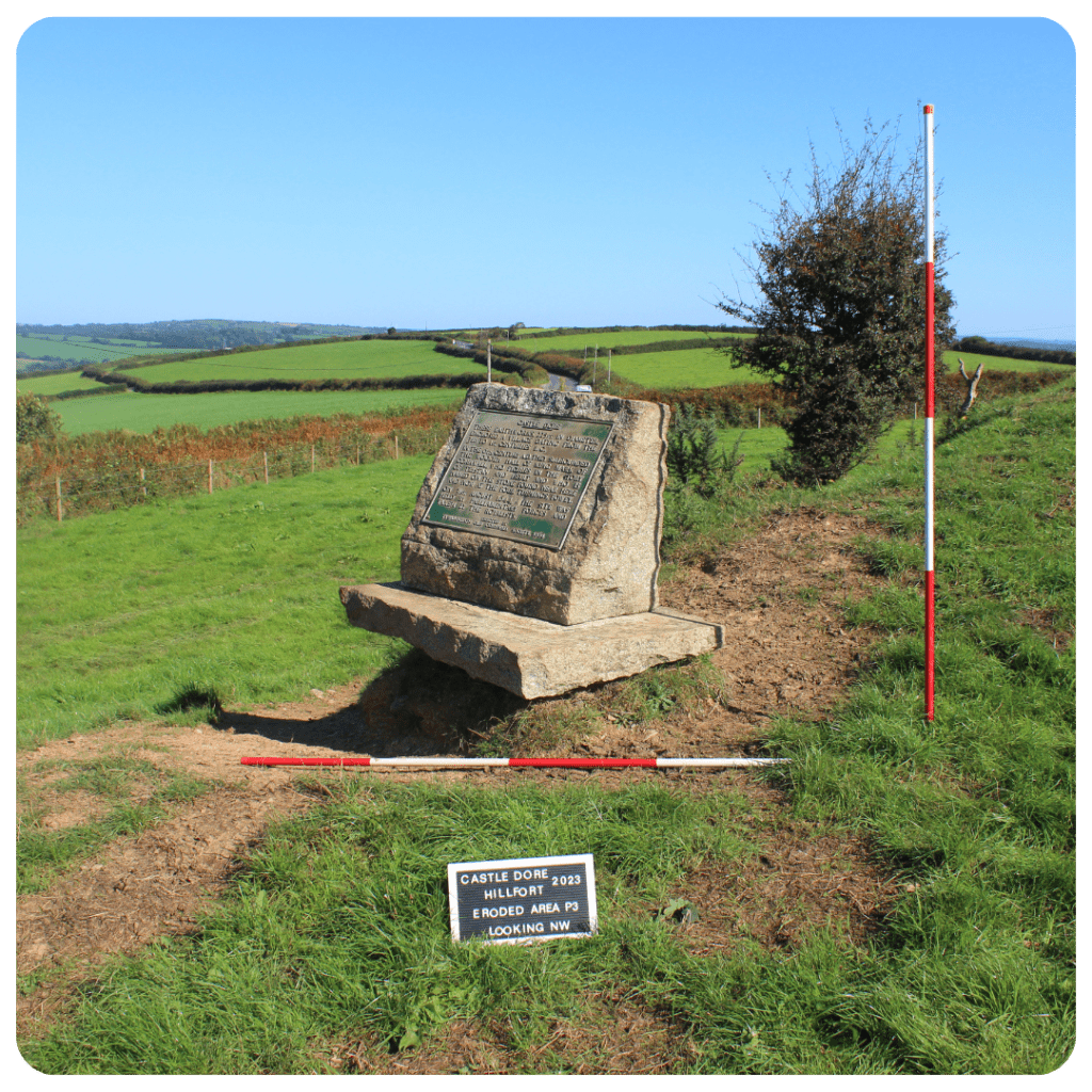
Castle Dore is a small multivallate hillfort, surviving as a roughly circular central area defined by a well-constructed inner rampart and ditch. A partial excavation of the hillfort interior by CA Raleigh-Radford in 1936-7 provided a 5th – 4th centuries BC construction date (based on ceramic evidence), followed by a period of abandonment after which the entrance area was remodelled (probably in the 4th – 3rd centuries BC).
The interior contained a number of four to six post structures and the remains of some round houses, defined by stake holes indicating a complex building sequence with frequent replacements of structures over a prolonged period. Two oval structures may also represent Romano-British or later occupation, although the pottery assemblage seems to indicate abandonment before the Roman period.
Excavated evidence also revealed the presence of finds relating to the battle between Charles I and the Earl of Essex, fought at Castle Dore during the Civil War when in 1644 Parliamentarian forces retreated into the earthworks and held the position until dark. As a result, Castle Dore is a registered battlefield as well as a scheduled monument.
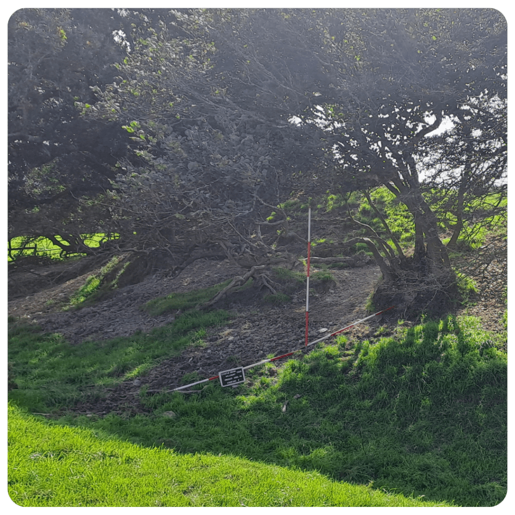
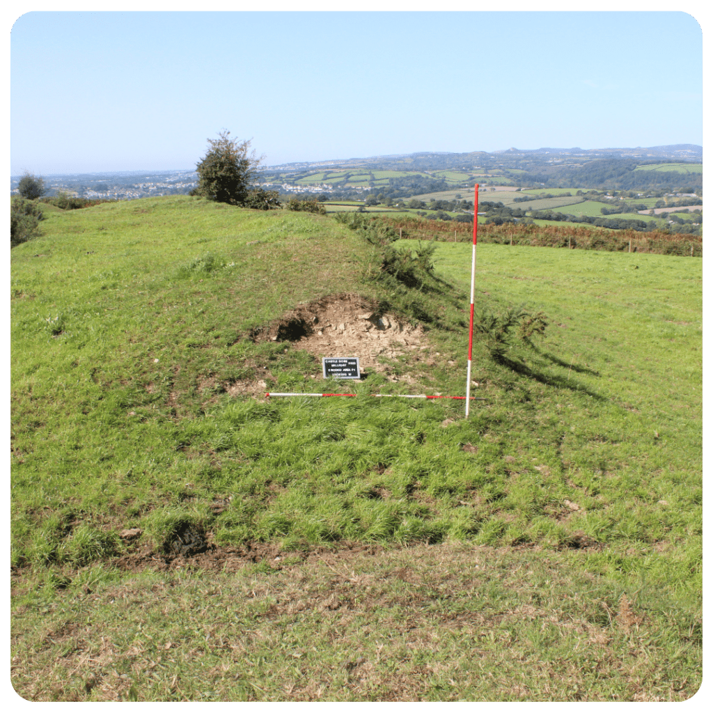
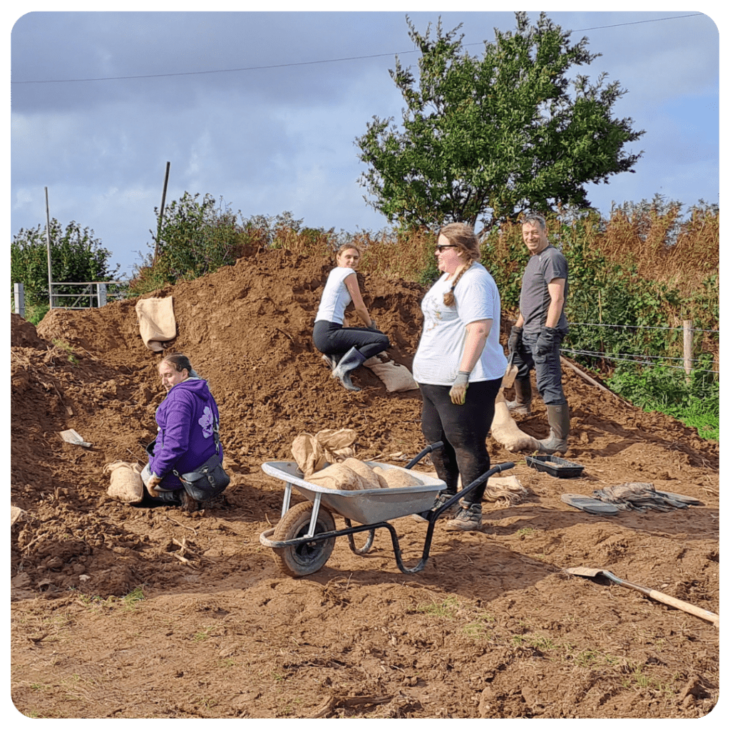
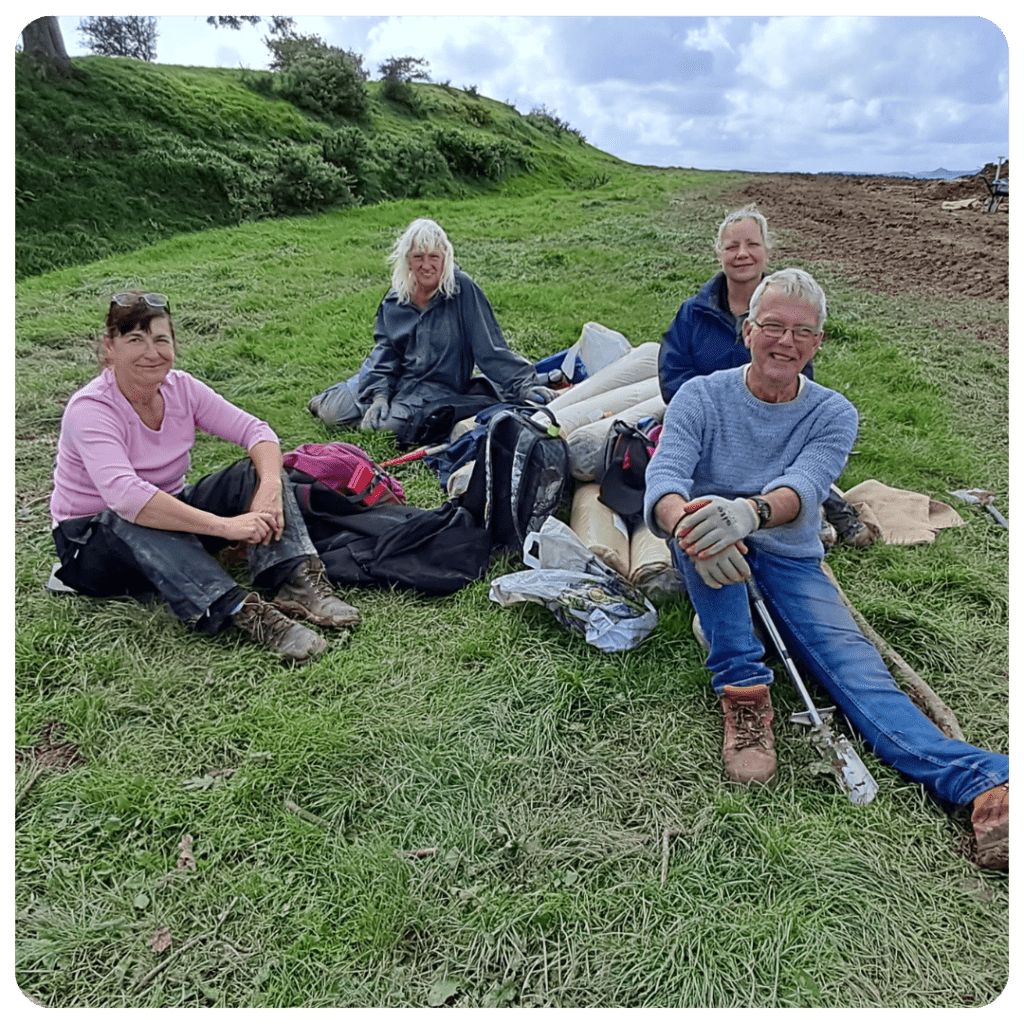
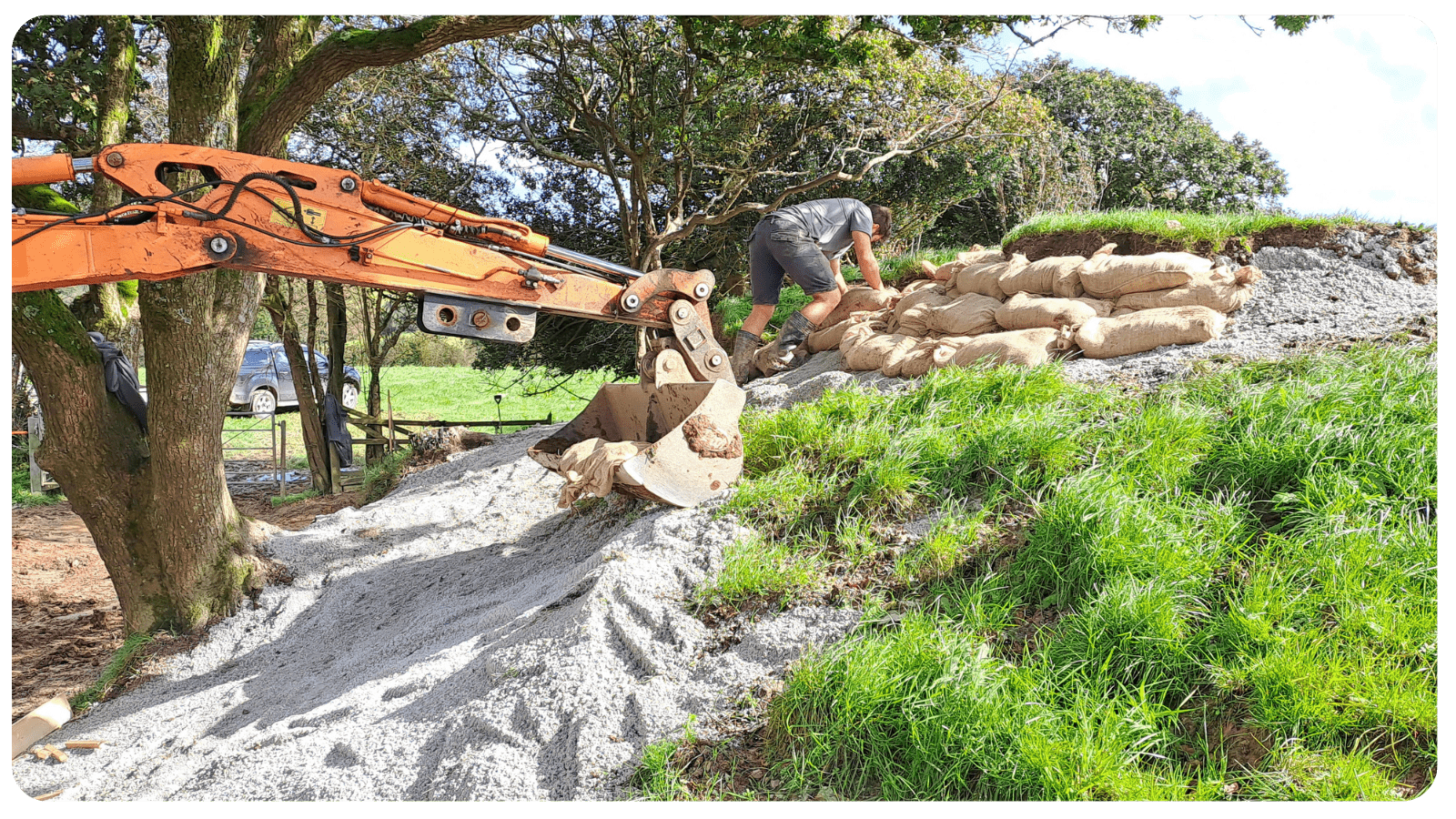
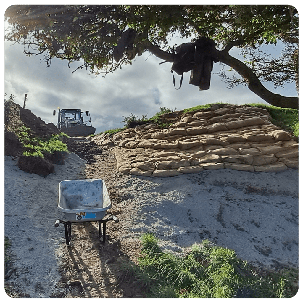
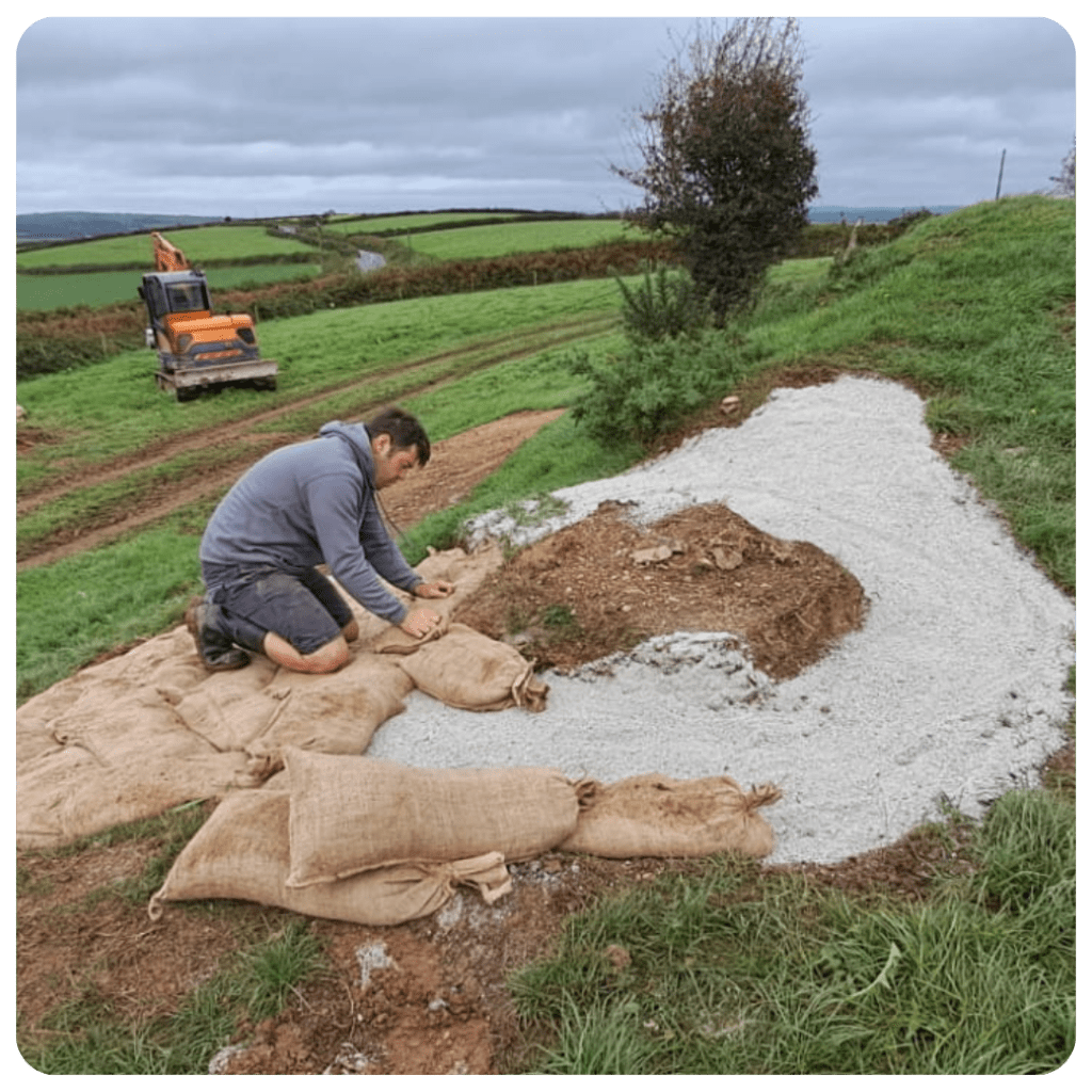
Through the Monumental Improvement project, the Cornwall Archaeological Unit were commissioned to carried out a programme of work to help assess the hillfort’s condition and develop management proposals for the site. This included a desktop assessment and detailed earthwork survey. As the site is currently listed on the Heritage at Risk Register as a result of erosion caused by stock, these management proposals were largely focused around fixing the eroded areas with the aim of securing the sites removal from the At Risk Register.
In addition, the team also removed some small and dead trees from the monument which were affecting the largest area of erosion. We also re-sited the interpretation panel and installed an accessible kissing gate nearer the main road making the site more noticeable, furthermore we relocated a water trough and created a new gateway in order to encourage cattle away from the monument.

We will be collating digital assets for this site including drone imagery, a 360-degree video, a 3D photogrammetry model and a reconstruction illustration of what the site may have looked like. All of these assets will create digital interpretation for the site giving people a greater understanding of the monuments significance.