Monitoring & Evidence
Our objectives can be achieved through various means such as but not...
View page

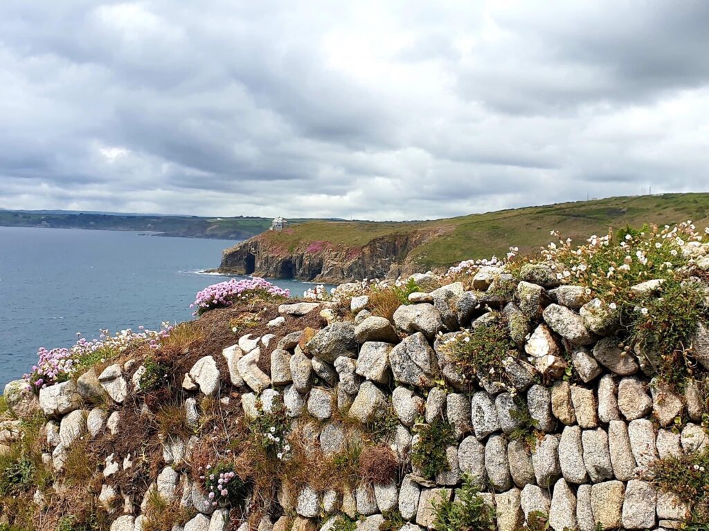
The key landscape characteristic of this section of Cornwall National Landscape is defined by its distinct, gentle, undulating land sloping down into the broad Camel valley. The Camel Estuary is approximately one kilometre wide between Padstow and Rock and stretches inland for around seven kilometres where it narrows significantly at Wadebridge but remains tidal for several kilometres beyond.


This AONB section includes the Camel Estuary and runs west from Wadebridge to Padstow and the adjacent land. It is bounded by the A389 and A39 to the south and west, and the B3314 to the northeast and extends almost as far north as the edge of Rock, Splatt and Tredrizzick.
| AONB Section | Cornwall's Landscape Character areas | Marine Character Areas covering the coast/adjacent waters |
|---|---|---|
|
CA19: Trevose Head and Coastal Plateau CA33: Camel and Allen Valleys CA34: Camel Estuary |
MCA 45: Port Gaverne Bay to St Ives Bay |
The Key Landscape Characteristic of this section of the AONB is defined by its distinct, gentle, undulating land sloping down into the broad Camel valley.
Creating a Sense of Place


The 18-mile long multi-use Camel Trail is managed and maintained by Cornwall Council.

The policies and objectives below are applicable to this Local Section – they should, however, be read in conjunction with the Cornwall AONB Strategy Aims, Policies and Objectives which are applicable to the whole designation.
Seek reduction of impacts on landscape character and tranquillity from major roads such as the A39, A389 and B3314 by for example reduction in street lighting, reduction in signage, less intensive management of roadside vegetation, non-intrusive methods of traffic calming and local hedging styles and materials in highway works.
References to the main aims, policies & objectives
Seek retention of the quiet rural character of small lanes such as those leading from settlement edges and off major roads to the edge of the estuary.
References to the main aims, policies & objectives
Support the co-ordinated management of the activities taking place on the Camel Trail and other recreational facilities to ensure that they do not detract from tranquillity or visual amenity, to the benefit of all users.
References to the main aims, policies & objectives
Require consideration of the landscape and visual impacts around the Camel Estuary of increasing or changing patterns of water-based access, leisure and commercial activity and related infrastructure.
References to the main aims, policies & objectives
Support an improvement in car free access options including foot, cycle, bus and ferry around the estuary, for example the continuation of the existing ferry link between Padstow and Rock.
References to the main aims, policies & objectives
Consider settlement growth to Rock, Splatt, Padsto and Wadebridge to ensure that it conserves and enhances the natural beauty of the Camel Estuary and does not adversely impact upon the AONB or its setting.
References to the main aims, policies & objectives
 Policy LS-P1
Policy LS-P2
Policy LS-P3
Policy LS-P4
Policy LS-P6
Objective LS-Ob6
Policy LS-P1
Policy LS-P2
Policy LS-P3
Policy LS-P4
Policy LS-P6
Objective LS-Ob6
 Objective NRLM-Ob9
Objective NRLM-Ob11
Objective NRLM-Ob9
Objective NRLM-Ob11
 Policy CCBR-P1
Objective CCBR-Ob4
Policy CCBR-P1
Objective CCBR-Ob4
 Objective HC-Ob1
Objective HC-Ob4
Policy RSA-P1
Policy RSA-P2
Objective RSA-Ob4
Objective RSA-Ob5
Objective HWB-Ob2
Policy SCE-P2
Policy SCE-P5
Policy SCE-P6
Objective SCE-Ob1
Objective SCE-Ob5
Policy PD-P1
Policy PD-P2
Policy PD-P3
Policy PD-P7
Policy PD-P12
Objective HC-Ob1
Objective HC-Ob4
Policy RSA-P1
Policy RSA-P2
Objective RSA-Ob4
Objective RSA-Ob5
Objective HWB-Ob2
Policy SCE-P2
Policy SCE-P5
Policy SCE-P6
Objective SCE-Ob1
Objective SCE-Ob5
Policy PD-P1
Policy PD-P2
Policy PD-P3
Policy PD-P7
Policy PD-P12
Limit spread of uncharacteristic development of replacement dwellings and commercial development including hotels and caravan parks.
References to the main aims, policies & objectives
Policy LS-P1
Policy LS-P2
Policy LS-P3
Policy LS-P4
Policy LS-P6
Objective LS-Ob6
Objective NRLM-Ob11
Objective HC-Ob4
Objective RSA-Ob5
Policy SCE-P3
Policy SCE-P5
Policy SCE-P6
Objective SCE-Ob1
Objective SCE-Ob2
Objective SCE-Ob3
Objective SCE-Ob5
Policy PD-P1
Policy PD-P2
Policy PD-P3
Policy PD-P9
Policy PD-P12
Policy PD-P18
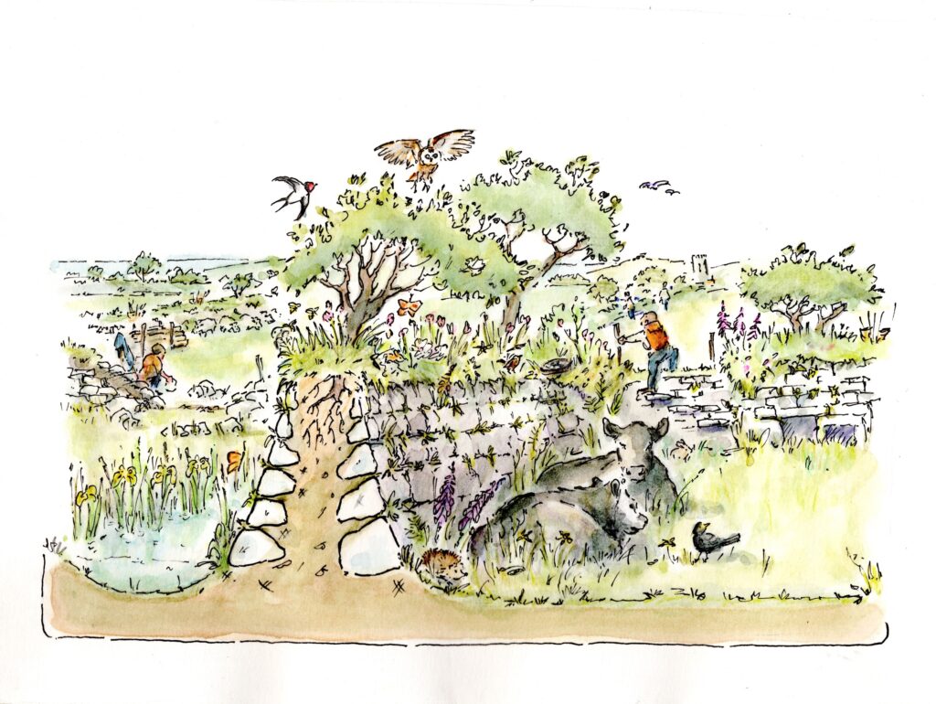
Support proposals which enhance protection for important habitats and species around the estuary
References to the main aims, policies & objectives
Policy LS-P2
Policy LS-P3
Objective LS-Ob6
Objective NRLM-Ob1
Objective NRLM-Ob2
Objective NRLM-Ob3
Objective NRLM-Ob5
Objective NRLM-Ob6
Objective NRLM-Ob7
Objective NRLM-Ob8
Objective NRLM-Ob9
Objective NRLM-Ob10
Objective NRLM-Ob11
Objective NRLM-Ob12
Objective NRLM-Ob13
Policy CCBR-P1
Objective CCBR-Ob1
Objective CCBR-Ob2
Objective CCBR-Ob3
Objective CCBR-Ob4
Objective RSA-Ob1
Objective RSA-Ob3
Objective RSA-Ob5
Objective HWB-Ob5
Policy SCE-P6
Objective SCE-Ob1
Objective SCE-Ob2
Objective SCE-Ob4
Objective SCE-Ob7
Support the continued reversion to marshland in the upper reaches of the Camel Estuary, for example at Amble Marshes, where drainage and agricultural improvement has taken place in order to restore to favourable condition this locally characteristic and significant habitat in the context of a landscape scale approach
References to the main aims, policies & objectives
Policy LS-P1
Policy LS-P2
Policy LS-P3
Policy LS-P4
Objective LS-Ob1
Objective LS-Ob2
Objective LS-Ob3
Objective LS-Ob4
Objective LS-Ob5
Objective NRLM-Ob1
Objective NRLM-Ob2
Objective NRLM-Ob3
Objective NRLM-Ob5
Objective NRLM-Ob6
Objective NRLM-Ob9
Objective NRLM-Ob12
Objective NRLM-Ob13
Policy CCBR-P1
Objective CCBR-Ob1
Objective CCBR-Ob2
Objective CCBR-Ob3
Objective CCBR-Ob4
Objective CCBR-Ob5
Objective RSA-Ob3
Objective RSA-Ob5
Objective HWB-Ob2
Objective HWB-Ob5
Policy SCE-P2
Policy SCE-P3
Policy SCE-P6
Objective SCE-Ob1
Objective SCE-Ob2
Objective SCE-Ob3
Objective SCE-Ob4
Seek to protect mature trees surrounding settlements for example at Padstow, Rock, Splatt and Wadebridge in order to conserve their contribution to local landscape character.
References to the main aims, policies & objectives
Related topics and useful links
The Management Plan is a shared strategy for those who live, work and visit the Cornwall Area of Outstanding Natural Beauty.
Further details on the Monument Improvement Project

