Monitoring & Evidence
Our objectives can be achieved through various means such as but not...
View page

This area shares similar landscape characteristics to the Helford River but on a much larger scale. The main channel is formed where the River
Fal meets the open sea, this stretch of water is known as the Carrick Roads. It is broad and deep, providing shelter in its deep-water
harbour for ocean going vessels. From the Roseland & Mevagissey to St Austell Bay the key landscape characteristic is a ridge which separates the Roseland from the Carrick Roads, consisting of a narrow strip of land barely half a kilometre wide between Zone Point and Gerrans Bay, broadens to include a stretch of varied and scenic coastland around Veryan Bay. The core part of the Roseland includes the five parishes of St Just-in-Roseland, Veryan, Gerrans, Philleigh and Ruan Lanihorne. St Mawes is a key coastal settlement at the mouth of the Fal, now largely established on tourism, with a busy and picturesque harbour.


The south coast central section of the Cornwall AONB extends from Porthpean near St Austell in the east and includes the Roseland Peninsula, the Fal Ria (including the Carrick Roads upstream from Trefusis Point/ St Anthony Head) to just south of the A390 near Tresillian and west almost to Perranarworthal and beyond to the edge of Penryn.
| AONB Section | Cornwall's Landscape Character areas | Marine Character Areas covering the coast/adjacent waters |
|---|---|---|
|
CA11: Redruth, Camborne and Gwennap CA13: Fal Ria, Truro & Falmouth CA16: Mid Fal Plateau CA40: Gerrans, Veryan and Mevagissey Bays |
MCA 49: South Cornwall Coastal Waters and Estuaries |
The Key Landscape Characteristics of this section of the AONB can be described by two distinct landscape character types.
This area shares similar landscape characteristics to the Helford River and estuary as described in Section 8, South Coast Western, but on a much larger scale. The main channel is formed where the River Fal meets the open sea, this stretch of water is known as the Carrick Roads. It is broad and deep, providing shelter in its deep-water harbour for ocean going vessels.
The mouth of the estuary is flanked by the historic landmarks of St Mawes Castle to the east and Pendennis Castle to the west (outside the AONB) – both important strategic fortifications guarding the Carrick Roads since the time of Henry VIII. The ria system of the Fal is more extensive with larger and more sinuous creeks than seen on the Helford and extends up to Truro at Malpas and Calenick.
On both banks of the Fal there has been a noticeable increase in the built environment with many of the original villages, established as a result of the former boat building, fishing and industrial trade now subject to further residential development namely, Flushing, Mylor Churchtown, Mylor Bridge, Restronguet Passage and Feock. The cumulative effects of this more recent development has given rise to areas of suburban character occupying the setting of traditional characterful villages with the greatest development pressure on areas with coastal views.
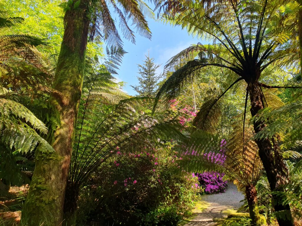
The slopes enclosing the Carrick Roads and creeks reflect a very similar landscape to the Helford but with a lesser concentration of woodland, which is replaced by large fields of pasture and arable land extending

The key landscape characteristic is a ridge which separates the Roseland from the Carrick Roads, consisting of a narrow strip of land barely half a kilometre wide between Zone Point and Gerrans Bay, broadens to include a stretch of varied and scenic coastland around Veryan Bay. The core part of the Roseland includes the five parishes of St Just-in-Roseland, Veryan, Gerrans, Philleigh and Ruan Lanihorne. St Mawes is a key coastal settlement at the mouth of the Fal, now largely established on tourism, with a busy and picturesque harbour.
Further north, lays the historic village of St Just-in-Roseland, characteristically positioned at the head of a small creek and dominated by its exceptional 13th century church which is said to be of 6th century origin. Further north, along the banks of the Fal, the parish of St Michael Penkevil is a much-folded landscape of wooded valleys, large parts of which are managed by the Tregothnan Estate. Along the coast to the east of St Mawes, in sheltered bays, lay the coastal settlements of Porthscatho, Portloe and Portholland, all rooted in the pilchard fishing industry and still engaged with fishing today. The overriding sense of the Roseland is of an extremely tranquil and well-managed farmed landscape with a globally renowned, stunning coastline that extends east across Mevagissey Bay and on to St Austell Bay in the north.
Away from the coast, aside from the church towns of Veryan and Gorran, settlement is still sparse and consists of mainly small rural hamlets and farmsteads linked by narrow winding lanes. At narrow junctions, traditional black and white cast iron directional fingerposts echo a bygone era. In the Gorran High Lanes/ Mevagissey hinterland, an extensive area of fields bounded by modern concrete walls mark out the former extent of the Heligan estate, incompatible with this rural landscape.
Along the coast, there are many small fishing villages such as the attractive historic village of Mevagissey, once the centre of Cornwall’s pilchard fishing industry, which still retains its working harbour. Many of the old buildings in the village are constructed of cob and slate and bear testimony to a time when the large shoals of pilchards were the livelihood of the whole village. Nowadays Mevagissey is a popular tourist destination and commuter village for both St Austell and Truro.

Great northern and black-throated diver


State of the AONB Report 2021
Fal oysters are registered as a Protected Designation of Origin.
The Helford and Fal Estuaries are a SAC for their shallow inlets and bays; the designation also covers saltmarshes, intertidal mudflats and sub tidal sandbanks.
Falmouth Bay to St Austell Bay is a Special Protection Area (SPA)
The Monumental Improvement project will ensure that 38 Scheduled Monuments in the Cornwall National Landscape will be better identified, supported and enjoyed by a wide range of communities and visitors.
Veryan Castle, or the Ringarounds, is an Iron Age or Romano-British defended site called a ’multiple enclosure fort’ built over 2,000 years ago in the Iron Age.

A legendary site, Carne Beacon is a Bronze Age funerary monument called a barrow with commanding views over the coast line below.
Black Head Cliff Castle is an Iron Age promontory fort (c. 2800-2000 years ago) on a dramatic rocky headland dividing St Austell and Mevagissey Bays

Roundwood Promontory Fort is a rare Iron Age promontory fort and post medieval Quay projecting into the River Fal with a rich industrial history.


FiPL-funded project transforms community land into a hub for food, nature, and wellbeing A Farming in Protected Landscapes (FiPL) funded project on the South coast of Cornwall has achieved wide-ranging…

Intro Paragraph

Farming in Protected Landscapes (FiPL) is a programme providing grant-funding for Farmers and Landowners designed to deliver for People, Place, Nature and Climate. The programme is funded by Defra and delivered by Cornwall National Landscape.
FiPL is helping to address the climate and biodiversity crisis, improve people’s engagement with the landscape, and support sustainable farm businesses and communities.

Some Cornish Hedges are over 3,500 yrs old! Making them one of the oldest human-made structures still used for their original purpose. As old as the Pyramids, neither a hedgerow or a dry-stone wall, they are unique and mainly found in Cornwall.
Despite their importance, there is a significant gap in evidence at scale to fully capture the contributions of Cornish Hedges to ecosystem services and natural capital value.

An anthology of short fiction inspired by Cornwall’s protected landscape.
Increasing access to the protected landscape, for those underserved, and connecting people with place. This project uses the arts as a mechanism to connect more people with nature.
The policies and objectives below are applicable to this Local Section – they should, however, be read in conjunction with the Cornwall AONB Strategy Aims, Policies and Objectives which are applicable to the whole designation.
Prevent further cumulative landscape and visual impact from individual developments on local character and tranquillity for example along the shores and slopes of the Fal Ria and creek side, waterside and coastal settlements. Require all new development, including replacement dwellings, to respond appropriately to the sensitivity and capacity of the landscape and to reflect the traditional and characteristic built form and context.
References to the main aims, policies & objectives
 Policy LS-P1
Policy LS-P2
Policy LS-P3
Policy LS-P4
Policy LS-P6
Policy LS-P1
Policy LS-P2
Policy LS-P3
Policy LS-P4
Policy LS-P6
 Objective NRLM-Ob11
 Objective HC-Ob1
Objective HC-Ob4
Objective HC-Ob12
Policy RSA-P1
Objective RSA-Ob5
Objective HC-Ob1
Objective HC-Ob4
Objective HC-Ob12
Policy RSA-P1
Objective RSA-Ob5
 Policy SCE-P2
Policy SCE-P3
Policy SCE-P5
Policy SCE-P6
Objective SCE-Ob1
Objective SCE-Ob5
Policy PD-P1
Policy PD-P2
Policy PD-P3
Policy PD-P12
Policy PD-P17
Policy SCE-P2
Policy SCE-P3
Policy SCE-P5
Policy SCE-P6
Objective SCE-Ob1
Objective SCE-Ob5
Policy PD-P1
Policy PD-P2
Policy PD-P3
Policy PD-P12
Policy PD-P17
Require the active consideration of landscape an visual impacts on the AONB landscape around the Fal Ria, Carrick Roads and associated creeks from increasing or changing patterns of water-based access, leisure and commercial activity and their related infrastructure such as moorings, jetties, car parks, yards and slipways associated with individual dwellings. Recognising the cumulative impacts of existing and further development.
References to the main aims, policies & objectives
Policy LS-P1
Policy LS-P2
Policy LS-P3
Policy LS-P4
Policy LS-P6
Objective LS-Ob6
Objective NRLM-Ob9
Objective NRLM-Ob11
Objective HC-Ob1
Objective HC-Ob2
Policy RSA-P1
Policy RSA-P2
Objective RSA-Ob4
Objective HWB-Ob2
Objective HWB-Ob5
Policy SCE-P2
Policy SCE-P3
Policy SCE-P5
Policy SCE-P6
Objective SCE-Ob1
Objective SCE-Ob3
Objective SCE-Ob5
Require an improvement in car-free access options including, foot, cycle, bus and boat for example from Truro, Falmouth and Penryn in a manner that conserves and enhances the AONB, building on the good work of the Fal River Partnership and Fal River Links.
References to the main aims, policies & objectives
Policy LS-P1
Policy LS-P2
Objective LS-Ob6
Objective HC-Ob11
Policy RSA-P1
Policy RSA-P2
Policy RSA-P3
Policy RSA-P4
Objective RSA-Ob1
Objective RSA-Ob2
Objective RSA-Ob3
Objective RSA-Ob4
Objective HWB-Ob1
Objective HWB-Ob2
Objective HWB-Ob3
Objective HWB-Ob4
Objective HWB-Ob5
Policy SCE-P3
Policy SCE-P4
Policy SCE-P6
Objective SCE-Ob1
Objective SCE-Ob3
Objective SCE-Ob5
Objective SCE-Ob6
Support appropriate improvements to footpath access around the Carrick Roads and its creeks with respect to the Marine and Coastal Access Act 2009 where this does not encourage an increase in traffic levels or the provision of further car parks in the area, provided that this does not impact upon the qualifying features of the Fal & Helford SAC from recreational disturbance.
References to the main aims, policies & objectives
Policy LS-P1
Policy LS-P2
Objective LS-Ob6
Objective NRLM-Ob9
Objective CCBR-Ob4
Policy RSA-P1
Policy RSA-P2
Policy RSA-P3
Objective RSA-Ob1
Objective RSA-Ob2
Objective RSA-Ob3
Objective RSA-Ob4
Objective HWB-Ob1
Objective HWB-Ob2
Objective HWB-Ob3
Objective HWB-Ob4
Objective HWB-Ob5
Policy SCE-P3
Policy SCE-P6
Objective SCE-Ob1
Objective SCE-Ob5
Support management of visitor car parking in quiet and remote tranquil rural areas in the Fal Ria and throughout the Roseland, up to Porthpean, so that levels of use do not increase. Resist additional parking provision as part of visitor proposal
preferring and requiring sustainable transport arrangements. Reduce visual impacts by use of carefully located unobtrusive small scale dispersed rural car parks set back from the coast for example as managed by the National Trust at Vault Bay and Dodman Point.
References to the main aims, policies & objectives
Require protection of the landscape setting of key landmarks such as St Mawes Castle, St Anthony’s Lighthouse and others from negative impacts by new development including housing and lighting and seek enhancement of their settings
References to the main aims, policies & objectives
Policy LS-P1
Policy LS-P2
Policy LS-P3
Policy LS-P4
Policy LS-P6
Objective NRLM-Ob11
Objective HC-Ob1
Objective HC-Ob4
Objective HC-Ob7
Objective HC-Ob12
Objective HC-Ob14
Policy RSA-P1
Objective HWB-Ob2
Objective HWB-Ob5
Policy SCE-P2
Policy SCE-P3
Policy SCE-P5
Policy SCE-P6
Objective SCE-Ob1
Policy PD-P1
Policy PD-P2
Policy PD-P7
Policy PD-P12
Policy PD-P18
Help to support coastal management which promotes natural processes wherever possible and support initiatives with communities which consider the long term future of coastal areas e.g. Falmouth, St Mawes, Mevagissey, Mylor, Devoran, Penryn and Flushing in respect to predicted effects of sea level rise and increased storminess. Seek to support the delivery of appropriate measures to ‘hold the line’ and ‘manage realignment’ as identified in the Shoreline Management Plan where they conserve or enhance the landscape character and natural beauty of the AONB.
References to the main aims, policies & objectives
Ensure that the conservation and enhancement of the special qualities of the AONB is fully taken into account in development proposals for expansion of Truro, Falmouth and Penryn and at smaller settlements in order to retain the character of the Fal Ria landscape. Particular care should be taken to ensure that no development is permitted inside or outside the AONB, which would damage its natural beauty, character and special qualities.
References to the main aims, policies & objectives
Support the continuation of small-scale, sustainable fisheries, including at Mevagissey and Portscatho, which enhance local character and communities and conserve natural assets. Support local cultural fisheries in the Fal Estuary such as traditional oyster fisheries, which do not impact upon the special features of the Special Area of Conservation.
References to the main aims, policies & objectives
Seek a reduction in landscape and visual impacts of tourism including better integration of existing holiday sites, visitor infrastructure, car parks and signage. Pay particular attention to increase in scale, massing and cumulative development and respect local character in external works, landscaping, site design and layout including at Mevagissey, Gorran Haven and Pentewan.
References to the main aims, policies & objectives
Policy LS-P1
Policy LS-P2
Policy LS-P3
Policy LS-P4
Policy LS-P6
Objective LS-Ob6
Objective NRLM-Ob11
Objective HC-Ob1
Objective HC-Ob4
Objective HC-Ob11
Policy RSA-P1
Policy RSA-P2
Objective RSA-Ob4
Objective RSA-Ob5
Policy SCE-P2
Policy SCE-P3
Policy SCE-P5
Policy SCE-P6
Objective SCE-Ob1
Objective SCE-Ob5
Policy PD-P9
Support the management and extension of sessile oak woodlands around the Fal and its tributaries and in the inland and coastal valleys of the Roseland. Consider opportunities for planting of local provenance native tree species such as sessile oak, hazel and alder to increase estuarine woodland cover and act as a future seed source where this is currently absent or sparse to assist subsequent natural regeneration.
References to the main aims, policies & objectives
Policy LS-P1
Objective LS-Ob1
Objective LS-Ob2
Objective LS-Ob3
Objective NRLM-Ob1
Objective NRLM-Ob3
Objective NRLM-Ob5
Objective NRLM-Ob12
Objective NRLM-Ob13
Policy CCBR-P1
Objective CCBR-Ob1
Objective CCBR-Ob2
Objective CCBR-Ob3
Objective HWB-Ob5
Policy SCE-P4
Objective SCE-Ob1
Objective SCE-Ob2
Objective SCE-Ob3
Objective SCE-Ob4
Support the continued success of festival that promote and interpret the AONB’s special qualities, characteristics and culture. For example, the Fal River Festival, Mevagissey Feast Week, Fal Oyster Festival, The St Mawes Fish Festival and the Fal Autumn Walking Festival
References to the main aims, policies & objectives
Related topics and useful links
The Management Plan is a shared strategy for those who live, work and visit the Cornwall Area of Outstanding Natural Beauty.
Further details on the Monument Improvement Project


